Introduction
Drone services Carson Valley are advancing rapidly, revolutionizing photography, inspection, surveying, and more. Particularly in scenic areas like Carson Valley and Lake Tahoe, drone technology is not only taking flight—it’s reshaping entire industries. From real estate and construction to agriculture and emergency response, the future of drone services in this part of Nevada is bright and full of promise.
In this post, we’ll explore how emerging drone technologies benefit local businesses and communities, discuss innovative applications specific to Carson Valley and Lake Tahoe, and show how companies can leverage these drone services to gain a competitive edge.
Table of Contents
1. Aerial Photography: Elevating Local Marketing
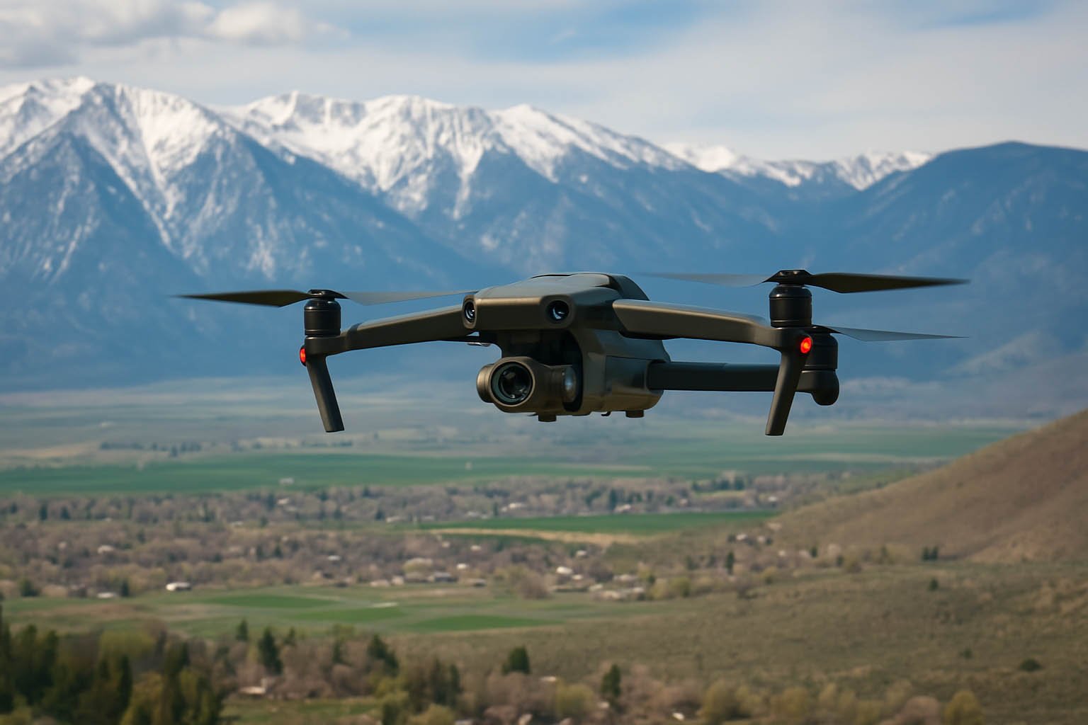
One of the most in-demand applications of drone services in Carson Valley and Lake Tahoe is aerial photography—and for good reason. This region is known for its breathtaking landscapes, from dramatic snow-capped peaks to crystal-clear alpine lakes and expansive ranch lands. These natural elements create stunning visual content that is simply not possible to capture from the ground.
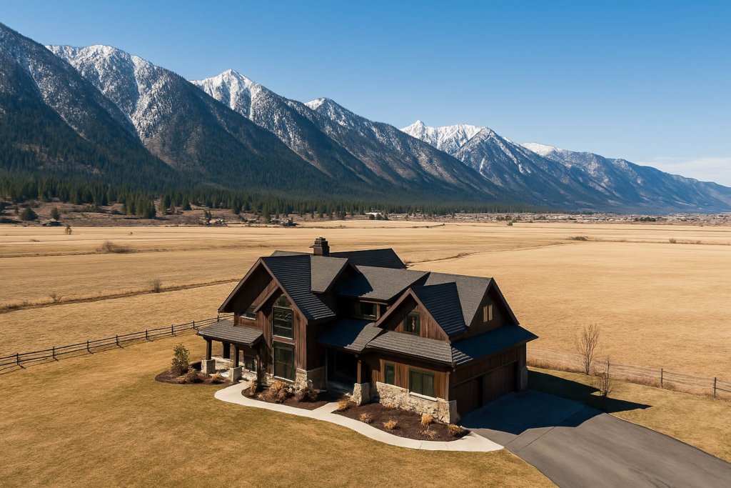
Real estate professionals are among the biggest beneficiaries of drone photography. By using drones to capture high-resolution aerial images and sweeping video tours, agents can showcase a property’s full footprint—its lot size, orientation, surrounding terrain, and even proximity to nearby amenities. These comprehensive views allow potential buyers to understand the full value of a listing without even stepping foot on the property. Listings enhanced with aerial visuals not only stand out online but also tend to sell faster and at higher prices.
Beyond real estate, local businesses are leveraging drone imagery to elevate their marketing strategies. Resorts and boutique hotels use aerial shots to emphasize their scenic locations and unique layouts. Wedding venues use drone footage to highlight outdoor ceremony spaces with mountain or lake views. Golf courses showcase aerial flyovers of their fairways and greens to attract more players. All of these industries benefit from the ability to create scroll-stopping content for social media, websites, and promotional campaigns.
Drone photography is also an effective tool for destination marketing, helping attract tourism to the Carson Valley and Lake Tahoe regions. Drones can capture the kind of cinematic footage that makes viewers feel like they’re already there—immersed in the beauty of Northern Nevada.
In short, aerial photography is no longer a luxury—it’s a strategic marketing necessity for any business that wants to stand out in today’s visually driven digital world.
2. Drone Inspections for Infrastructure and Agriculture
Drone inspections are rapidly becoming the preferred solution for a wide range of industries in Carson Valley and Lake Tahoe. This region’s mix of rural terrain, wide-open spaces, and remote infrastructure makes traditional inspection methods both labor-intensive and expensive. Drones offer a faster, safer, and more efficient alternative—reducing risk while increasing accuracy.
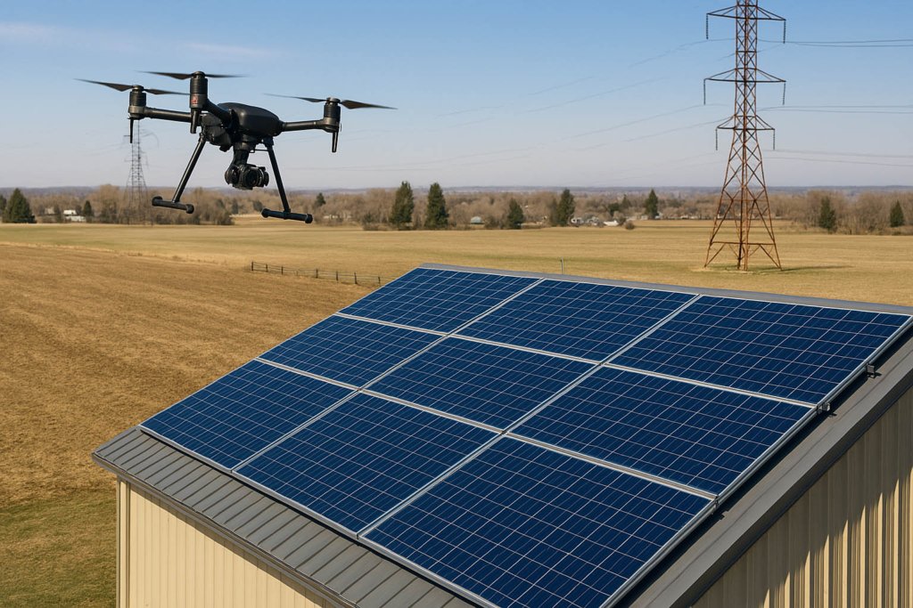
One of the most common applications is roof and solar panel inspections. Drones equipped with high-resolution cameras can quickly scan rooftops for damage, wear, or installation issues, all without the need for ladders or safety harnesses. For solar arrays, thermal imaging sensors can detect faulty or underperforming panels, saving property owners time and energy costs.
In utility infrastructure, drones are now essential tools for inspecting cell towers, transmission lines, and substations. These structures are often located in difficult-to-reach areas or at dangerous heights. With drones, technicians can remotely assess conditions in real-time, using zoom capabilities and AI-assisted analysis to identify corrosion, broken components, or overheating—all while avoiding potentially hazardous climbs.
Agriculture is another major area of impact. Farmers in the Carson Valley are utilizing precision agriculture drones to monitor crop health, evaluate soil conditions, and even detect irrigation inefficiencies. Multispectral and thermal sensors can pinpoint areas of drought stress or pest damage before they become large-scale issues, improving yield and reducing waste.
Additionally, LIDAR-equipped drones provide high-resolution 3D mapping of fields and infrastructure, enabling detailed planning for future development or environmental management. This technology is particularly valuable in regions with uneven or heavily vegetated terrain.
Whether it’s for efficiency, safety, or better data, drone inspections are transforming how local businesses, farms, and utility companies manage their assets. As these technologies continue to evolve, their role in infrastructure and agriculture will only expand—making them a vital tool in the modern operations toolkit.cially benefiting from drone technology. Using precision agriculture drones, they can monitor crop health, soil conditions, and water usage with pinpoint accuracy, reducing waste and increasing yield.
3. Construction and Development: Streamlining Progress with Drones
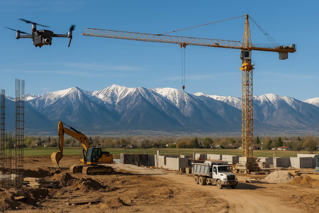
Across Nevada—and especially in fast-growing areas like Carson Valley and Lake Tahoe—construction drones are transforming the way developers, builders, and contractors plan and manage their projects. These high-tech tools bring speed, precision, and cost savings to every phase of construction, making them indispensable on modern job sites.
One of the most powerful applications is site surveying and 3D mapping. Traditional land surveys can take days or even weeks, especially on large or uneven terrain. Drones equipped with photogrammetry or LIDAR technology can perform detailed topographic surveys in a fraction of the time. This allows engineers and planners to generate accurate 3D models, calculate cut and fill volumes, and better understand the physical landscape before breaking ground.
Progress monitoring is another critical function. Drones can conduct routine flyovers of active job sites to capture updated visuals from consistent vantage points. These images can then be compared over time, providing stakeholders with a clear visual timeline of construction milestones. This is especially useful for project managers who need to keep clients informed and ensure contractors stay on schedule.
Additionally, drones assist in equipment and material tracking. From overhead, they can monitor the locations of vehicles, materials, and storage areas—helping reduce theft, loss, and delays. For large-scale developments, this oversight boosts operational efficiency and safety compliance.
In Carson Valley, where residential and commercial developments are on the rise, drone surveying is helping builders stay ahead of demand while managing costs. Meanwhile, in Lake Tahoe, where strict environmental regulations govern land use, drones play a vital role in ensuring compliance by tracking erosion, grading accuracy, and land disturbance.
With real-time data, precision mapping, and visual documentation, drones are reshaping the future of construction. They’re not just a tool—they’re a competitive advantage in a high-stakes, fast-moving industry.ions are strict, drone surveys help ensure compliance with erosion control, land use, and development guidelines.
4. Emergency Services and Public Safety
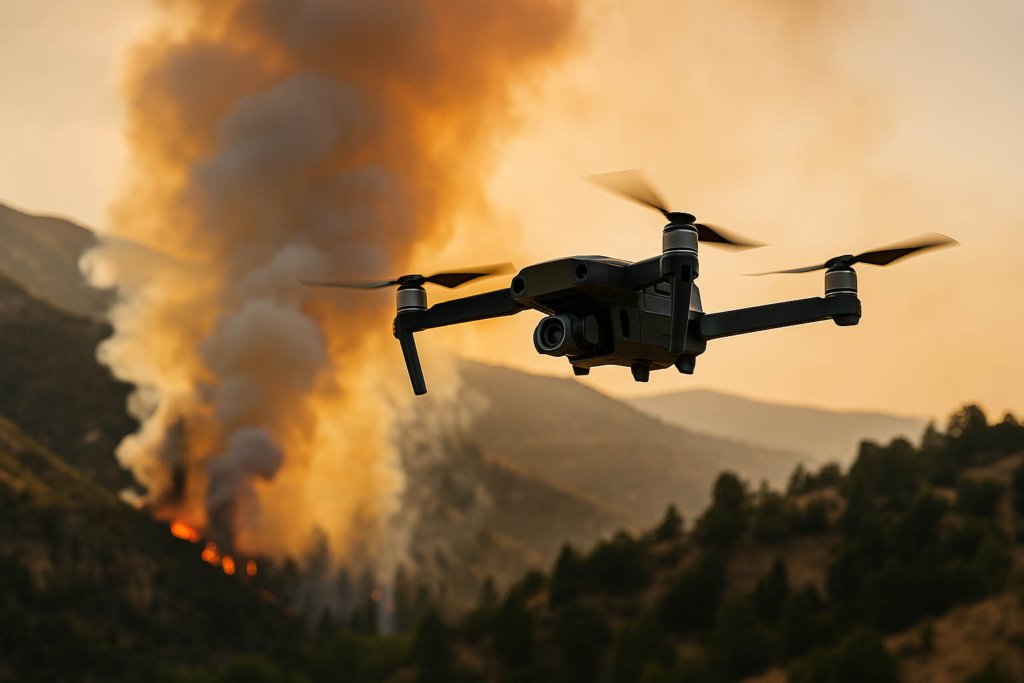
As wildfires and natural disasters become more common in the Sierra Nevada, emergency response teams are using drones to gain real-time situational awareness.
Drones can:
- Map fire perimeters
- Locate missing persons
- Survey flood damage
- Deliver emergency supplies to inaccessible areas
Public safety agencies in Douglas County and surrounding areas are beginning to incorporate these tools into their protocols, saving lives and protecting property.
5. Emerging Drone Technologies Shaping the Future
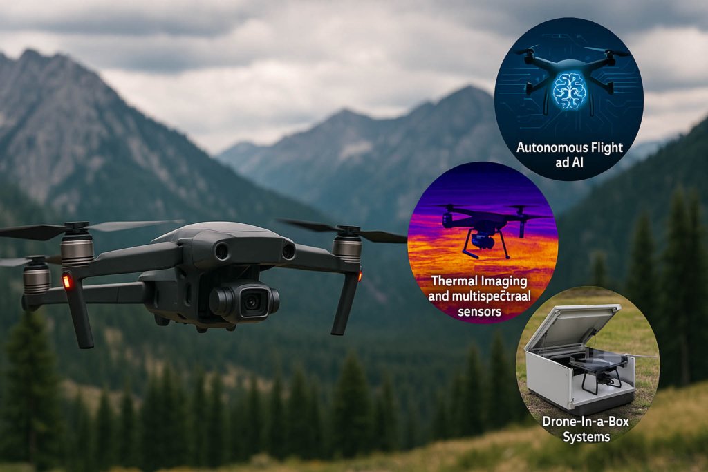
As drone adoption accelerates across Carson Valley and Lake Tahoe, emerging technologies are unlocking powerful new capabilities. These innovations are expanding the range of industries drones can serve and increasing the precision, safety, and efficiency of each mission. Let’s explore some of the most exciting advancements reshaping the future of drone services in this region.
Autonomous Flight and AI Integration
Autonomous drones, enhanced by artificial intelligence, are becoming a game-changer. These drones can execute complex flight plans without manual control, making them ideal for routine tasks such as property monitoring, infrastructure inspections, or wildlife tracking. With machine learning, drones can recognize patterns, detect anomalies, and even make real-time decisions—reducing the need for constant human oversight and improving data accuracy over time.
Thermal Imaging and Multispectral Sensors
Drones equipped with thermal and multispectral cameras are being widely adopted in sectors like agriculture, search and rescue, and environmental conservation. In farming, these sensors help detect plant stress, irrigation issues, and nutrient deficiencies before they become visible to the naked eye. In emergency situations, thermal cameras can locate missing persons, detect fire hotspots, or assess building heat loss—providing rapid insight when every second counts.
LIDAR Mapping for Precision Surveying
LIDAR (Light Detection and Ranging) is one of the most transformative tools for modern surveying. LIDAR-equipped drones can generate detailed 3D models of landscapes, even penetrating dense vegetation. This makes them invaluable in forested areas, mountainous terrain, and environmentally sensitive zones like the Lake Tahoe basin. They provide unparalleled detail for developers, conservationists, and government agencies alike.
Drone-in-a-Box Systems
Drone-in-a-box solutions offer fully automated operations, including launch, flight, recharge, and data upload. Perfect for municipal surveillance, infrastructure monitoring, and industrial security, these systems allow for scheduled or triggered deployments—providing a hands-off, always-ready drone solution.
These technologies are not just the future—they’re arriving now in Carson Valley and Lake Tahoe.
6. Local Opportunities: Why Businesses Should Act Now
Local Opportunities: Why Businesses Should Act Now
In today’s fast-paced, tech-driven landscape, early adopters of drone technology gain a distinct advantage—especially in communities like Carson Valley and Lake Tahoe, where diverse industries thrive amid dramatic natural landscapes. Whether you operate in real estate, construction, tourism, agriculture, or public services, integrating drone services into your operations can lead to cost savings, better data, and stronger marketing performance.
Drones offer a level of efficiency and insight that traditional methods simply can’t match. Real estate professionals can close deals faster with breathtaking aerial imagery. Construction managers can track site progress and materials with pinpoint accuracy. Ranchers and farmers can monitor land conditions and livestock in real-time. And tourism businesses can create promotional content that captures the area’s natural beauty from awe-inspiring new angles.
By partnering with a local drone company like Sierra Drone Concepts, businesses not only gain access to professional-grade equipment and certified FAA-licensed pilots—they also benefit from hyper-local knowledge of terrain, regulations, and weather conditions. This ensures safer flights, smoother operations, and more tailored results.
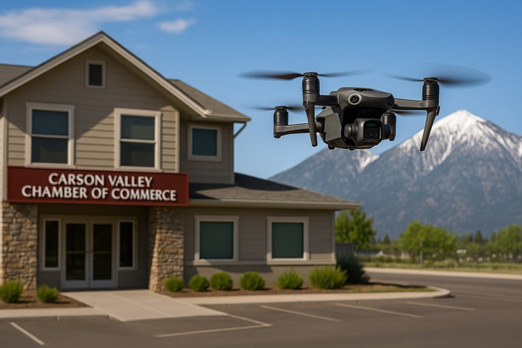
Additionally, being connected to the Carson Valley Chamber of Commerce or other local organizations can amplify your investment in drone technology. These partnerships can increase community visibility, lead to collaborative marketing opportunities, and demonstrate your commitment to innovation and sustainability.
Working with a local provider brings additional benefits that national services can’t replicate:
- Fast turnaround times for urgent projects or last-minute needs
- In-depth knowledge of regional zoning, airspace, and elevation challenges
- Personalized service that adapts to your unique goals and brand identity
Adopting drone services now positions your business as a leader—one that’s proactive, modern, and ready to embrace the future. In a competitive region like Carson Valley, that edge makes all the difference.
7. Community Impact: Drones for Good
Drone services aren’t limited to commercial ventures—they’re also becoming powerful tools for community development, environmental stewardship, and nonprofit outreach. In Carson Valley and Lake Tahoe, where natural beauty and wildlife preservation are central to local identity, drones play a critical role in helping organizations protect, promote, and preserve their surroundings.
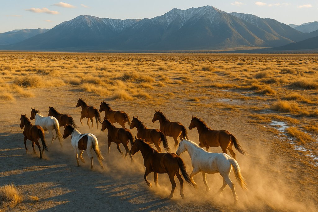
Local nonprofits and environmental groups are increasingly turning to drones to capture impactful visuals and gather essential data. High-resolution aerial imagery can bring attention to causes that might otherwise go unnoticed. Whether it’s a video showing the migration of wild horses, or overhead shots of forested areas affected by illegal dumping, drone footage has a unique ability to tell stories from above—inspiring action and support.
One of the most impactful uses is in tracking wildlife populations. Drones allow conservationists to monitor animals like deer, elk, or wild horses without disturbing their natural behavior. This hands-off approach improves data accuracy and reduces stress on the animals, all while keeping field teams safer and more efficient.
Additionally, drones are invaluable for monitoring environmental concerns such as invasive species growth, illegal land use, or pollution in remote or hard-to-reach areas. Instead of relying on extensive ground surveys, organizations can conduct quick flyovers, capturing images that can be analyzed and archived over time to track progress or degradation.
For fundraising and outreach efforts, drones provide stunning, cinematic content that boosts visibility across websites, social media, and campaign videos. Aerial footage offers a fresh perspective that captivates donors and stakeholders, making the cause more relatable and urgent.
By investing in drone services, local organizations gain a powerful ally—one that helps elevate their mission, expand their reach, and make a lasting impact in the community. In this way, drones are helping build a better, more connected Carson Valley and Lake Tahoe.
8. The Road Ahead: What to Expect in the Next 5 Years
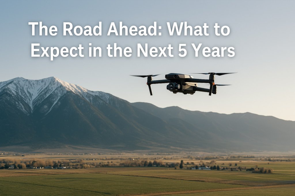
The drone industry is evolving rapidly, and Carson Valley and Lake Tahoe are perfectly positioned to benefit from the next wave of innovation. In the coming years, we anticipate a significant expansion in how drones are used across both the public and private sectors—transforming workflows, improving safety, and opening new economic opportunities throughout the region.
One of the most prominent trends will be the widespread adoption of drone services in construction and real estate. As demand grows for faster, more accurate project management and eye-catching marketing content, drones will become standard tools on job sites and in property listings. From 3D site surveys to high-quality video tours, drone capabilities are raising the bar for what clients and buyers expect.
We’ll also see a major increase in fire prevention and disaster response applications. In a region vulnerable to wildfires and severe weather events, drones offer critical advantages—such as aerial mapping of fire perimeters, monitoring high-risk zones, and providing real-time data to first responders. Their ability to access hard-to-reach areas quickly and safely can be the difference between containment and catastrophe.
In agriculture, autonomous drones are set to become the norm. These drones will perform tasks like crop monitoring, irrigation mapping, and even precision spraying without constant manual input—saving farmers time and maximizing yields. AI-powered analysis will allow for predictive insights that further enhance efficiency.
With this growth comes the need for stronger FAA regulations and clearer operational guidelines, especially for commercial users. As drone activity increases, businesses and municipalities will need to stay informed and compliant to operate safely and legally.
Ultimately, the next five years will be defined by integration and innovation. Those who embrace drone technology early will enjoy a competitive edge—and help shape the future of how Northern Nevada builds, grows, and protects its communities.ments that invest in drone partnerships today will be better equipped to innovate and respond tomorrow.
Final Thoughts
Drone services in Carson Valley and Lake Tahoe are not just a passing trend—they are the future. With advancements in technology, increased accessibility, and rising demand across industries, drones are becoming an indispensable tool for progress, safety, and storytelling.
Whether you’re a business owner, developer, farmer, or public official, now is the time to explore how drone services Carson Valley and drone services Lake Tahoe can elevate your work and impact.
Need Drone Services in Carson Valley or Lake Tahoe?
Sierra Drone Concepts provides professional, FAA-certified aerial photography, mapping, inspections, and surveying for businesses, municipalities, and nonprofits. Contact us today to learn more or schedule a consultation.
FAQs About Drone Services in Carson Valley and Lake Tahoe
What are the main benefits of drone services in Carson Valley and Lake Tahoe?
Drone services offer enhanced aerial photography for real estate, accurate surveying for construction, precise agricultural monitoring, and efficient emergency response capabilities. They provide safer, faster, and more cost-effective solutions than traditional methods.
Are drone services legally permitted in Carson Valley and Lake Tahoe regions?
Yes, drone services are legal, provided they adhere to FAA regulations. Professional drone operators must be FAA-certified, follow local laws, and obtain necessary permits for certain activities, especially near airports or sensitive environments.
How can drones help local businesses stand out?
Businesses leveraging drone services gain superior marketing content, precise data collection, improved operational efficiency, and enhanced safety measures. Drone technology helps them differentiate their offerings and remain competitive.
Which industries in Carson Valley and Lake Tahoe benefit most from drone technology?
Industries such as real estate, construction, agriculture, tourism, infrastructure management, and emergency services experience significant advantages from adopting drone technology.
How accurate are drone surveys and inspections?
Modern drones equipped with LIDAR, high-resolution cameras, and GPS technologies provide extremely accurate data, often down to centimeters or millimeters, ideal for detailed inspections and precise measurements.
How much do professional drone services cost?
Costs vary based on the service, complexity, duration, and equipment required. Typically, professional drone services in Carson Valley and Lake Tahoe start from a few hundred dollars for simple aerial photography to several thousand dollars for complex surveys and inspections.
Can drones operate in challenging weather conditions?
Advanced drones are capable of operating in moderately adverse conditions, including mild wind and rain. However, severe weather such as heavy rain, snow, or strong winds typically limits safe operation.
How do I choose the right drone service provider?
Choose a provider who is FAA-certified, insured, experienced in your industry, familiar with local terrain, and equipped with advanced technology. Ask for references or view a portfolio to gauge their capabilities.
What is the future outlook for drone services in the Carson Valley and Lake Tahoe area?
The future is promising, with increased adoption across various sectors. Expect advancements in autonomous flight, AI integration, improved sensor technology, and expanded regulatory clarity, further driving innovation and growth.
How can my business start using drone services?
Reach out to local drone experts like Sierra Drone Concepts for a consultation. They will help identify your needs, advise on the best solutions, and manage the entire drone operation from planning to delivery.