Our Projects
Extreme Aerial Photography and Video Artistry for Lifestyle, Action and Commerce
Request a Quote
ObJective
An engineering firm needed to gather up-to-date, high quality surface data to assess recent damage from a landslide. The firm was tasked with recommending erosion control measures, so it was important to capture uphill creek beds and potential sources of water.
Problem
The extremely mountainous terrain and low satellite visibility meant that a traditional GPS topo was not feasible. Furthermore, there were multiple creek beds that covered an elevation change of over 600 feet.
Solution
Utilize the new Terrain Follow feature as part of the latest drone sensing technology, we were able to accurately map approximately 80 acres of hillside without any distortion by maintaining a consistent AGL height. We were also able to save a huge chunk of time and resources by completing the project in one field visit.
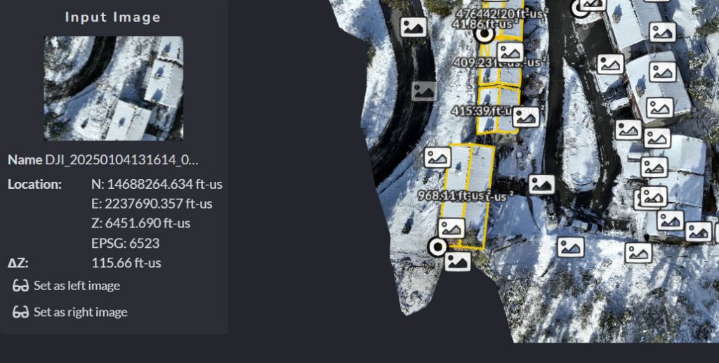
A property manager in Lake Tahoe was in need of square footage calculations quick measurements on the building’s footprint. We deployed our DJI Mavic 3E to capture the entire site, and develop a planimetric survey for the buildings in question. Drone technology allowed us to provide a cost-effective and timely solution to a task that would have normally taken a survey team several days to complete.
ObJective
A local ski resort needed two surface profiles their engineers could compare for a new chairlift alignment.
Problem
Given the nature of the steep and rocky terrain, it would be very labor intensive and hazardous for a ground crew to collect surface data.
Solution
Combining traditional survey methods to establish aerial ground control points, and using an RTK drone with mission-planned Terrain Awareness from a digital elevation model, we were able to efficiently and safely survey the entire ski-run in one day gathering high quality data over areas that would otherwise be inaccessible.
ObJective
A 1700’ acre ranch wanted a complete topographic map and high resolution orthophoto.
Problem
The timeline needed to produce a map on a working farm, over 2 square miles in size with active irrigation and livestock.
Solution
Working in close collaboration with a Professional Land Surveyor also overseeing the boundary survey, it was quickly determined to deploy an RTK drone. With this ability we were able to strategically place ground control points and reduce the risk of aerial targets getting destroyed by water or animals before the flight, saving time from collecting insufficient data as well as minimizing the amount of GPS observations needed to set ground control. RTK capabilities reduced field time by weeks compared to a non-RTK drone, and possibly months compared to traditional survey methods.